169 years (and more) of the U.S.-Canada border
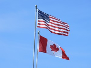
Before moving to Canton, N.Y., I had never seen a Canadian flag flying alongside an American flag. The red maple leaf flag is a constant reminder of the fact that I live in a border region. It’s lucky the Canadian-American border is one of the longest demilitarized borders on the planet, but it’s important to remember that it was not always this way. Today marks the 169th anniversary of the Oregon Treaty which established the present border between the United States and Canada. Before this treaty, the U.S. and Canada had a long history of conflict.

Peace Arch Park-26 via Flickr
Both the United States and Canada were settled by the British and the French. These nations played a valuable role in our development as modern countries. To define national territory, wars like the French and Indian wars, the American Revolution, and the War of 1812 were fought for control of the American continent.
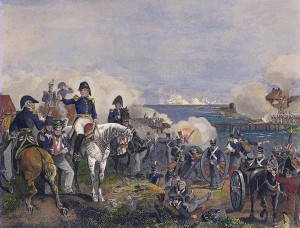
The War of 1812 played an important part in the development of Upstate New York’s border. In 1807 congress issued an embargo against trade with Britain and France along the St. Lawrence, an attempt to “Peacefully Coerce” the British out of their impressment policies, which was responsible for capturing American sailors and forcing them to serve in the British navy. The embargo proved to be ineffective; trade continued along the St. Lawrence River in secrecy. In an effort to enforce this embargo a garrison was raised in Ogdensburg. These soldiers quickly gained resentment from the local population; they harassed traders along the river by needlessly searching them. The garrison was eventually expelled from the region, and as the soldiers marched out they were met by jeers and insults from angry citizens. Throughout the War, numerous attempts were made to invade and seize parts of Canada. During the Battle of Queenstown Heights, American troops drove the British out of the Niagara peninsula. Later, American forces were driven back after a British counter attack. During the Battle of Ogdensburg, British troops crossed the St. Lawrence River and defeated the American garrison at Fort Oswegatchie. The Battle of Plattsburgh marked a key victory for American forces who routed a British force of 20,000 and forced them out of the Champlain Valley and north into Canada.

Battle of Plattsburgh by Alexander Macomb
At the end of the war, neither side accomplished any of their pre-war goals. The treaty of Ghent restored the former border set between the United States and Canada. However, the issue of where the final border would be placed remained unaddressed for decades.
1818 marked the first time in American history when a formal treaty was signed in an attempt to define the Northern American border. The Anglo-American convention declared the 49th parallel from Lake of the Woods, Michigan to the Rockies in the west would serve as the line in the sand.
As time went on, America’s borders remained undefined and other countries made claims to parts of the American continent. Alexander the First, the emperor of Russia, attempted to establish a fishing and whaling monopoly from the Bering Straits, to the 51st parallel. In response to this, President Monroe issued his famous Doctrine that stated the American continent would no longer be open territory for European conquest and colonization. Going forward, the United States stood firmly when it claimed its domain with in the western hemisphere.
In 1827, Great Britain and the United States met again to address the border issue, but nothing was accomplished, the nations agreed to postpone the issue for another year. In 1842, the northeastern sector of the border would be established, but the west side of the continent would be postponed for at least another decade.
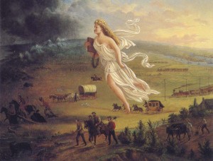
For decades the two nations pushed back the issue; neither country had a strong enough presence in the west to make claims to specific territories. In 1843, westward expansion into Oregon brought the border question up for a final review. President James K. Polk, a strong supporter of Manifest Destiny, proposed a settlement with the British government at the 49th degree parallel.

American Progress by John Gast
The settlement marked the stretch from the strait of Georgia to the Rockies as the west border. Great Britain formally gained control of Vancouver island and navigation rights in the Columbia River. The United States gained the territories of Oregon, Washington, Idaho, and Montana.
Today the border remains a complicated issue. At places like Point Roberts, and Campobello Island, students are forced to cross into another country in order to get to school because of boundaries which isolate areas of the nation in the neighboring country. There is also a twenty foot “No-Touching” zone, which is completely deforested, in order to clearly define the border. Overall, the United States and Canada have come a long way in developing a clearly defined border at the 49th parallel.


