Marking History in the North Country
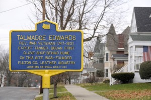
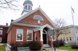
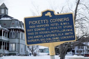
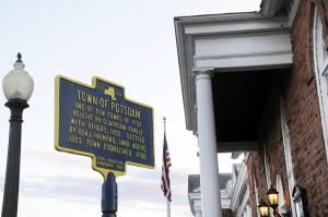
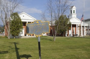
You’ve driven past them countless times and perhaps even stopped to read about the bit of very local history that took place on that very spot. They are the historic roadside markers found all around New York State, on main highways as well as the seldom traveled, off-the-beaten-path, side road. “George Washington Slept Here”…well, I haven’t come across that one yet but I have found several forest fires in the Adirondacks, Elizabeth Cady Stanton’s birthplace (Johnstown), where the iron for the Civil War ironclads came from (an iron mill in the town of Saranac), that there is only one courthouse from the colonial era in New York that is still in use (Fulton County), that John Brown’s body was kept under guard while it lay in rest overnight at the Essex County Courthouse in Elizabethtown while en-route to Lake Placid. The markers themselves sometimes even seem like a piece of history, many having been in their location for nearly 90 years, showing the weathering of that long time period. I found some markers that are identified by both the New York State Education and Conservation Departments have unique details –
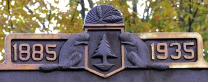
two beavers facing each other on opposite sides of a pine tree with dates at the top (1885 – 1935, obviously commemorating the 50th anniversary of the formation of the state forest preserve)
Markers put up by municipalities other than NYS have their own recognition and sometimes a logo (such as the shape of Fulton County with an acknowledgement of that county’s bicentennial on several relatively new markers in Fulton County)
Most markers were put up between 1926 and 1936 and the state provided funding for the project but that ran out around 1939. The program continued into the 1960s with coordination through the Office of State History of the Education Department but funds had to come from sources other than the state.
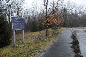
One of the newer large sized historic area markers, this being in a roadside rest area along Route 30 in the Adirodnacks just south of Speculator.
The speed of travel through the state landscape was significantly faster in the 1960s than in the 20s and 30s and it was thought inappropriate to erect the small markers on high-speed roads. Dozens of the large markers went up around the state by the late 60s. The Office of State History was still encouraging the use of the small markers but to be funded and erected by local communities and historical societies and hopefully with some consulting from that office.
Most people think this is still a state program but there is no funding from the New York (hasn’t been for a long time) and unless they are put up on state land, permission from SED is not required and many of the new markers never get as far as a state inventory and often don’t get any consultation from SED. The last time there was a significant effort to inventory these markers was in the late 40s and early 50s. Unfortunately, markers that were missing at that time were removed entirely from any list, including the content of the marker – no record of early markers that have disappeared exists.
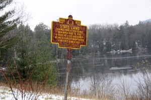
A vintage New York State historic marker at a roadside pull-off on Route 30 at the southern end of Tupper Lake. This marker is one that acknowledges the 50th anniversary of the creation of the forest preserve (1885-1935)
As I stop to check out these historic markers it occurs to me that the markers themselves have become an historic artifact. Many show their age and feel “historic” in themselves. As I come across these markers spread around the North Country I find that, although many are well maintained by local communities and history organizations, many are in rough shape. Some of the settings is not befitting these special pieces of North Country history – a recent stop at the Saranac River marker along Route 3 between Clayburg and Redford presented me with a garbage dump. It is at a small roadside pull-off, a rest stop, but I’d certainly not feel comfortable having lunch amongst the trash that has been conveniently dumped at this spot. My next trip up that way will have me with a trash bag and some extra time to stop and give the site a bit of a clean-up.
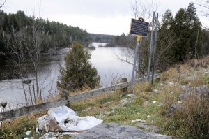
This historic marker along Route 3 between Clayburg and Redford briefly tells the story of the Saranac River. However, it’s location at a roadside pull-off reflects more of a trash dump than the beauty of the Saranac River.
Perhaps an “adopt a marker” program could be started for those neglected markers…and the events that took place on that particular piece of landscape will continue to be recognized as a special piece of New York State history and be remembered.


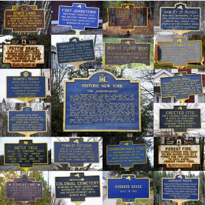


My favorite is along the Russell turnpike, south of Pierrepont. It marks the graves of a couple of poor boys who took sick and died along the way in the war of 1812. It’s sad to think of these fellows, out in the cold, and far from home.
Thanks for this post, Mark.
It’s interesting. I suspect it took a bit of work to compile too.
Nice story, Mark. It’s not right that more is not done to provide information about, preserve, protect, and encourage more of these markers.
Really nice story. I myself have pulled over to read some of those markers. It’s neat to think that our history is right there on the roadsides and parks for us to find. But I’m surprised you didn’t include the Martha Reben one along the shore of Lake Flower in Saranac Lake.
The Martha Reben marker…of course!…how could I forget that!? That marker is interesting in that it is quite a ways away from where Reben actually spent her time in the wilderness. if I recall the information on it correctly, it tells of her time on the Saranacs – where she spent her time was several miles (probably at least 10 miles) from the marker, up the chain of lakes on Weller Pond. I’ll photograph it tomorrow – add it to my collection of markers.