


Ontario’s other canal: the Trent-Severn Waterway
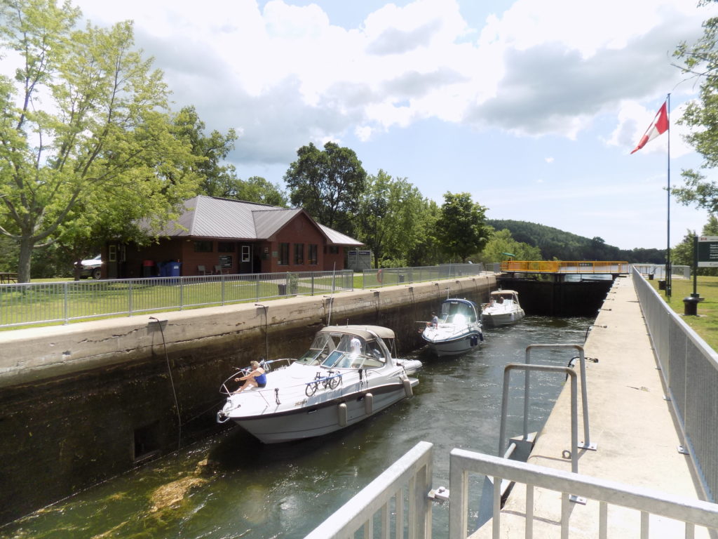
Upboand boats between the gates of Lock 6 in Frankford. The area between the gates is filling with water to lift the boats up to the proper level so they can exit.
Rivers, lakes, and locks
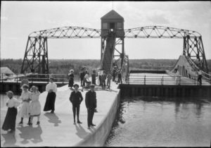
The Kirkfield Lift Lock in 1910. Library and Archives Canada, no restrictions on use, copyright expired.
There’s a shortcut across Ontario by boat. The Trent-Severn Waterway crosses south-central Ontario, connecting the Bay of Quinte on Lake Ontario to Georgian Bay on Lake Huron. The 240 mile/388-kilometer waterway goes from Trenton north along the Trent River to Rice Lake, then it follows the Otonabee River and the Kawartha Lakes into the Talbot River to Lakes Simcoe and Couchiching. Then, the waterway follows the Severn River through the southern part of the Muskoka District before it reaches Georgian Bay at Port Severn. There are 45 locks along the entire system. Landmark locks include the hydraulic lift locks in Peterborough and Kirkfield, and the flight locks at Ranney Falls and Healey Falls near Campbellford. The most unique feature along the system for moving boats from one elevation to another is the Big Chute Marine Railway on the Severn River. Watercraft board a railcar that looks like a boat trailer on tracks and it runs across dry land from one level to the next.
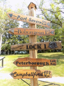
Signpost at Lock 1 showing distances to towns and cities along the Trent-Severn Waterway. Photo: James Morgan
History
The Trent-Severn Waterway has origins in developing transportation and military infrastructure for newly settled areas of Ontario. It took about 70 years to complete because it was so mired in partisan politics, bureaucracy, corruption, and conflicting economic interests. Until 1907, marine traffic couldn’t go between Balsam Lake and the Talbot River, which is the divide between the Trent and Severn watersheds. The Kirkfield Lift Lock opened that year and made it possible to travel from Georgian Bay to the Bay of Quinte without taking the long way around through the Great Lakes. The Peterborough Lift Lock was opened in 1904. The Big Chute Marine Railway first opened in 1917 and a new system opened in 1978. The lowest elevation is 244 feet/74.4 meters above sea level at the Bay of Quinte in Trenton. The summit is 841 feet/256 meters at Balsam Lake. The Port Severn terminus at Georgian Bay is 578 feet/176 meters above sea level.
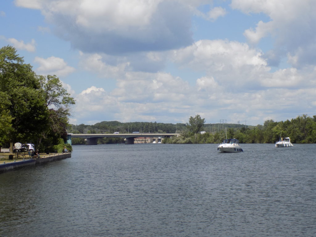
Looking north from Lock 1 on the Trent River towards the Highway 401 bridge. The historic Sidney Generating Station, dam, and Lock 2 Sidney are in the background. Photo: James Morgan
The waterway only operates from mid-May to mid-October now. Commercial traffic declined once the Welland Canal opened to carry ships from Lake Ontario to Lake Erie around Niagara Falls. Like it’s older eastern Ontario counterpart, the Rideau Canal, the Trent-Severn is now a National Historic Site and is operated by Parks Canada. At one time, many lockmasters lived in houses on the site of lock they operated. Some of those houses are still standing but are now vacant or are used for office and storage space. Some of the locks like Ranney Falls have automated controls now, while others such as Frankford still require park staff to hand operate the gates.
Waterway towns
For the first eight years of my life, I lived close to the Trent River in Frankford, where Lock 6 is located. Trenton is only 6 miles away, but there are five more locks located between the two places. Walking across the big bridge over the river to watch boats go through the locks was a popular activity. Every lock station has a picnic area and bathroom facilities. Most of them offer mooring sites and some even provide electrical outlets for boats. Parks Canada also allows land visitors to camp overnight at most lock stations.
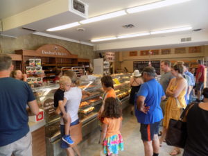
Dooher’s Bakery in Campbellford Ontario on Sweetest Bakery in Canada election day. Photo: James Morgan
The waterway towns all have their own unique character. Trenton has its Bay of Quinte shoreline. Frankford is small and friendly. Peterborough has big city services but with a small-town feeling. I recently was in Campbellford on a Saturday and there was an election going on at the extremely famous, and extremely good Dooher’s Bakery. This was an election to vote for the “Sweetest Bakery in Canada.” Ballots were being liberally distributed with Dooher’s already stamped in on the candidate line. It didn’t look too democratic, but I couldn’t disagree with the single candidate on the ballot because it won my support with cream-filled and glazed doughnuts and vanilla jam cookies. The inside of the bakery was chaos with shoppers and voters. The local TV station had already been there for a story. I sat outside, eating my purchases and got talking with a local family. I commented on the lineup and a guy said “Hell! that’s nothing, they were lined up down the block a couple of hours ago!” Someone shared the news that Dooher’s was in first place, narrowly edging out a bakery in Saskatchewan, but the official results won’t be revealed until September 14.
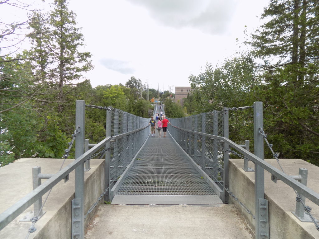
Looking across the Ranney Gorge Suspension Bridge at Ferris Provincial Park on the Trent River in Campbellford, Ontario. The Ranney Falls Generating Station is in the background. Photo: James Morgan
Industry
There are reminders of the waterway’s industrial past—and present, too. Paper mills are still located on the Trent at Glen Miller and Trenton. Ruins of old factories stand by the river in Frankford and Campbellford. The early years of electrical power in Ontario are visible all along the waterway. Generating stations built during the early 20th century are frequently next to the control dams along the main river channels beside canals and lock stations. One example is at Ranney Falls in Campbellford where the power station and locks are located across a gorge below the falls where a pedestrian suspension bridge connects to Ferris Provincial Park.
The Trent-Severn Waterway showcases great examples of Ontario’s geography, history, communities, and people.
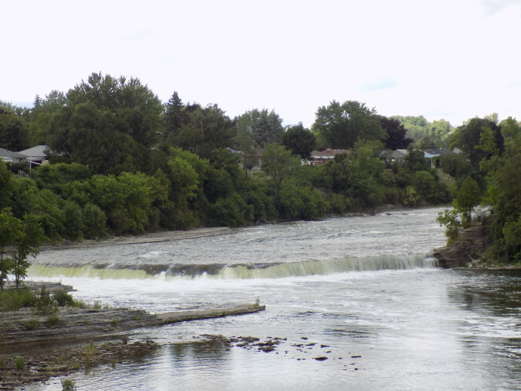
Ranney Falls on the Trent River in Campbellford, Ontario. The Ranney Falls locks on the Trent-Severn Waterway allow boats to bypass the falls and rapids. Photo: James Morgan
Tags: Campbellford Ontario, canada, Ferris Provincial Park, Frankford Ontario, Ontario, Trent-Severn Waterway National Historic Site, Trenton Ontario


