The cheap hikes
In recent years, it seems everyone is doing a trail guide of some kind. I’m going to take a different route: the “cheap hikes”–short and relatively easy, with great views for not a lot of effort or time, a big bang for your buck. These are hikes designed for when you don’t have the time or the stamina to do a high peak or even one of the medium hikes–like Ampersand, Loon Lake Mountain, St. Regis Mountain, Rooster Comb, Pitchoff or Debar–which require most of a day, at least if you plan to smell a few flowers along the way or linger awhile at the top.
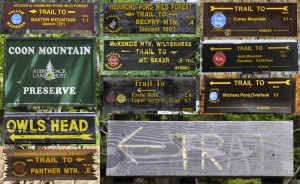
I’m not really going to give you much information – you will have to find these hikes the same way I did, by doing them yourself. I’ll give you a clue about finding the trailhead and you can figure out approximate lengths of these hikes from the trailhead signs in the composite photograph–many are about a mile, one way, a couple of them are a little longer.
Although hiking guides are handy, I like the discovery process–pouring over maps to find a trail in what looks like an interesting place. This approach makes me more aware of my surroundings when I’m hiking…rather than looking for that particularly unusual erratic at 1.24 mi. as noted in the guidebook, I’d rather just come across it. I don’t want the whole trip planned out for me ahead of time, telling me what to expect every inch of the way. Notice that none of my photographs show a view from any of the summits – that’s for you to discover.
So, here are some of my cheap hikes.
Panther Mountain – off Route 3 between Tupper Lake and Coreys (you’ve got to figure out where Coreys is).
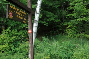
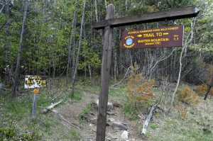
The trailhead for Mt. Baker, almost in downtown Saranac Lake and the only hike of the Saranac 6 that is a cheap hike. Photo: Mark Kurtz
Mount Baker – ask anyone in Saranac Lake where Baker is -just a short walk from downtown. I long ago lost track of how many times I’ve hiked Baker. There are two distinct overlooks, one on the summit and one not which makes it a really cheap hike. The trail for both starts at the same place. This is also one of the “Saranac Lake 6.”
Mount Jo – Adirondack Loj.
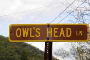
Owls Head – there are a bunch of Owls Heads in the Adirondacks – this one is off Route 73 between Lake Placid and Keene, closer to Keene.
Baxter Mountain – off Route 9N between Route 73 and Elizabethtown – great view looking up Keene Valley (oops – broke my rule and gave you a hint as to what to expect – okay, call that a teaser).
Castle Rock – off a secondary road in Blue Mountain Lake – this one is a bit longer, a couple of miles one-way.
Coney Mountain – off Route 30 between Tupper Lake and Long Lake (okay, that’s a long stretch of road – it is close to the Hamilton Co/Franklin Co line).
Mount Arab – off Mt. Arab Lake Road which is off the Conifer Road which is off Route 3 in Piercefield (jeez-m – I might as well take you there).
Coon Mountain – a side road off Lakeshore Road which runs between Westport and Essex.
Silver Lake Mountain – in “Hawkeye” by Silver Lake – this is a little tricky so I’ll give you some hints: you’ll have to drive a series of back roads deep in the Adirondack woods in the northeastern part of the park – east of Union Falls and Alder Brook.
Belfry Mountain – trail head on the Dalton Hill Road just outside of Witherbee – this hike is Wal-Mart cheap – less than half a mile.
Floodwood Mountain – off the Floodwood Road which is off Route 30 at Saranac Inn.
Jenkins Mountain – off Keese Mill Road (aka Keeses Mill Rd and Keese Mills Rd) near Paul Smiths.
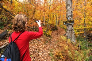
Hitchens Pond Overlook, a great cheap hike…after a three mile paddle. The hardwoods make for a spectacular fall hike. Photo: Mark Kurtz
Hitchens Pond Overlook – a cheap hike, only about a mile one way, but there is a caveat: a three mile paddle is required to get to the trailhead. So, not a quick trip when including the paddle…or a 3+ mile one way walk in on a road (actually a former railroad bed) from Horseshoe Lake but that certainly would take it off the cheap hike list. This trailhead is off the Bog River Flow.
Cathead Mountain – off the Benson Road, near Northville (the Benson Road is actually part of the Northville-Placid Trail – the first several miles of the southern end of that trail is on paved roads). I hiked this mountain when I lived in Northville – great for a quick mountain hike after work – fire tower on the summit. NOTE: unfortunately, this trail has been closed in recent years because of a land dispute. I don’t know if this has been resolved yet – the last time I was through there (couple years ago) it was still closed.
Now, the disclaimers…and you really have to read this!
I haven’t given you much information – you have to figure out these hikes yourself. Yes, you can Google them and get a bunch of info, which is also fun – it can be part of the process of finding hiking trails. I first hiked most of these long before Google existed. I used accurate topo maps to find trails and trailheads–that’s part of the fun of a hike, figuring it out.
Be prepared! Have proper clothing for the time of year you are hiking – remember, weather in the Adirondacks can turn on a dime – be prepared for anything…anything. Water, food, flashlight, etc – all the stuff you are supposed to take on a real hike, you take on a cheap hike as well and always–let me repeat– ALWAYS carry a current topo map and compass…and know how to use them! GPS is good but what happens when the batteries die!?…carry the map and compass also! I’m not much of a tech kinda guy so I don’t use GPS but many of my experienced and tech savvy fellow hiking friends who love GPS will also say “carry the map and compass!” A good friend of mine, very woods-savvy, got “turned around” (what you say when you don’t want to admit you were lost) coming off Baker Mountain right in Saranac Lake…twice!…yes, he was bushwhacking a different route off the top but it just goes to show, even the cheap hikes can get you in trouble quickly – that’s why you always go prepared.
I’ve done some research on these trips along the way – lots of interesting history, human and natural, on these trails and summits. Have fun getting to know these mountain hikes. And let me know about some of your cheap hikes. Don’t give too much away – we want to make our own discoveries as we travel these short paths to mountain summits and overlooks.

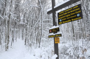
Home made signs can sometimes come into play when giving direction…or perhaps a land owner got sick of directing people to the trail head. Photo: Mark Kurtz
Tags: adirondacks, hiking, mountains, outdoors, trails




Great list!!
Yes, thanks Mark!
Great article Mark – one of my favorite cheap hikes without much vertical & a great view is to Moose Pond off Rt3 on the way from Saranac Lake to Bloomingdale